This blog is just getting started. Come back often for updates. Send me a note about places you think should be included, I'll do my best to get it done, PM me @ idahotraveler01@gmail.com.

Thanks for taking time to be here.

Showing posts with label Whitewater. Show all posts

Thursday, November 10, 2011

Idaho Vacation: Payette River Scenic Byway

The Payette River Scenic Byway is 112 miles of non-stop scenic views; most will simply take your breath away.  This byway is a great Idaho getaway vacation any season of the year.  This route has also been designated as a National Scenic Byway. 


Payette River Scenic Byway Information Sign
 The southern end of this byway is at the junction of ID-55 and ID 44 just west of Boise.  The route follows ID-55 to the northern terminus at New Meadows where ID-55 and US-95 meet. 

The southern portion of this byway skirts around the city of Eagle and heads north on the Horseshoe Bend road.  After topping the pass between the metro Boise area and Horseshoe Bend, the scenery changes to the Boise National Forest mountains.  The road drops in elevation down to Horseshoe Bend where we meet the Payette River.  Horseshoe Bend is named for the large horseshoe shaped bend in the river.

In addition to a few places to grab a bite to eat, there are two other reasons to make a stop in Horseshoe Bend.  The Thunder Mountain Line features scenic train rides along the Payette River.  Throughout the year they also have many themed and dinner rides.  Check them out here for a fun and different experience.  Zip Idaho gives a very different experience as it has a series of seven zip lines to let you soar between Ponderosa Pine trees or race with a friend on a 1460 foot long line over 100 feet above the ground below.  Information is found here.

One other note about Horseshoe Bend, it is best to not exceed the 25 MPH speed limit through town.  This author found that it is “strictly” enforced. 

Rafters Enjoying a Float Down The
Payette River

For the next 35 or so miles, the road follows the Payette River through a mostly narrow canyon.  Along the way we pass through the small burgs of Banks and Smith’s Ferry.  The scenery is beautiful and can be a distraction to drivers.  The river is relatively calm in the lower stretches but turns into a churning tumult as it  cascades over rocks higher upstream.  The stretch from Banks downstream to the Beehive Bend Sportsmen Access is the most heavily floated portion of the river and may be the most heavily used of any river in Idaho.  This stretch has mostly Class 1 and 2 rapids with one or two Class 3’s. 


Winter on The North Fork
Payette River
 Numerous outfitters and guides provide expert advice and equipment for river excursions.  Trips can be tailored to any age and/or experience level.  See contact information below.  The North Fork and South Fork Payette River join at Banks.  The South Fork is very popular for its many class 4 and 5 rapids.  The North Fork is mostly a continuous series of Class 5 rapids and is not suitable for rafters and kayakers who are not experts. 


Kayaking at Kelly's Whitewater Park near Cascade
 Several Forest Service campgrounds are located near the highway in this stretch and there are a number of turnouts to allow slower drivers to safely pullover and let those in a hurry to pass.  A number of turnouts allow for viewing rafters and kayakers on the river.  There is also a nice beach area a couple miles south of Banks.  There is also access to many secondary roads that lead away from the river and to many other camping and other outdoor recreational opportunities.  The road is open all seasons but will likely be snow covered and/or icy during winter months.  It is best to not be in a big hurry on this stretch of highway.


Rainbow Bridge Over North Fork
Payette River
 The highway east from Banks follows the South Fork Payette River.  This roadway is also the Wildlife Canyon Scenic Byway and is described  here.   Going east to Lowman, one has the choice of returning to the Boise area via ID-21 and the Ponderosa Pine Scenic Byway or continuing up river towards Stanley and the Sawtooth Mountains on the northern portion of the Ponderosa Pine Scenic Byway. This scenic byway is described here, here and here.

ID-55 Holiday Traffic Heading South Along the Payette River

ID-55 is one of two main highways from the Boise area to central and northern Idaho.  As such, it can be very busy, especially during summer and holiday weekends.  It is not uncommon for a steady stream of recreational vehicles, boats, ATV’s etc. to be headed north on Fridays and south on Sundays.  If your travels allow, plan to avoid these times. 


Cattle Grazing in a Meadow in
Long Valley

Fall Colors in Aspen Near Cascade
 A few miles north of Smith’s Ferry the road leaves the river and soon opens to the Round Valley prairies and meadows.  Another 5-6 miles and Round Valley is left behind and we enter the south end of Long Valley.  Long Valley stretches all the way to McCall.  Cascade is the next community we encounter.  Historically, Cascade was economically tied to the lumber industry.  Today, tourism and recreation top the economy. 


Fall Colors With Cascade Reservoir in Background
 Cascade is the gateway to Cascade Reservoir, a twenty mile long impoundment on the Payette River.  Year-round fishing highlights the outdoor activities here but there are certainly many additional activities in this outdoor wonderland including all kinds of water sports, bird watching, hiking, biking, snowmobiling, cross country skiing, and more.   

Lake Cascade State Park has nine campgrounds scattered around the reservoir with six boat launch ramps.  Some sites have water, sewer, and electricity.  There are also Forest Service campgrounds. 

FR 22 goes east of Cascade towards Warm Lake, South Fork of the Salmon River and Johnson Creek.  Access to many other lakes and streams are found in the area.  Tamarack Resort is located near the North West portion of the reservoir. 


Pastoral Scene With Tamarack Trees Changing Color
Near Smith's Ferry
 Continuing north on ID-55 we soon arrive in Donnelly, the main access point to Tamarack Resort.  Donnelly has a few stores, restaurants and gas stations but not much else.  We continue our trip towards McCall. 

The resort town of McCall is located on the southern end of Payette Lake and offers every amenity any traveler could want.  Ponderosa State park is just northeast of town and is described   .  There are numerous events throughout the year in McCall with the Winter Carnival the most well known.  Ice sculptures line the streets during the carnival which is held in late January and early February.  Brundage Mountain Ski Area and Resort is located just a few miles west of McCall

From McCall we head in a more westerly direction towards the community of New Meadows.  ID-55 and the Payette River Scenic Byway end in New Meadows where the highway intersects with US-95.  Turn right and head towards Riggins and Grangeville and points north or stay left and head towards Council and back to the western Treasure Valley area. 

The route makes a great day-trip loop or just go up and back on ID-55.  The scenery will look different depending on which way you travel.  This makes a wonderful Idaho vacation any season of the year. 

Additional Information:
Boise National Forest - http://fs.usda.gov/boise/
Idaho Outfitters and Guides Ass'n (White Water Trips) - http://www.ioga.org/
Idaho Historical Highway Marker Guide - http://itd.idaho.gov/hmg/
Cascade Chamber of Commerce - http://www.cascadechamber.com/
Donnelly Chamber of Commerce - http://www.donnellychamber.org/
McCall Chamber of Commerce - http://mccallchamber.org/
Brundage Mountain Ski Area and Resort - http://www.brundage.com/
New Meadows Area Information - http://meadowsvalley.com/


Wednesday, September 21, 2011

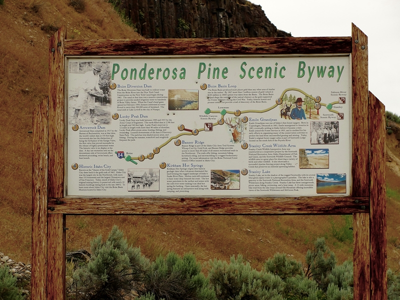
Idaho Vacation: Ponderosa Pine Scenic Byway, Part 3 Lowman to Stanley


Ponderosa Pine Scenic Byway near
Diversion Dam
 The Ponderosa Pine Scenic Byway is one of the most scenic and diversified byways imaginable.  It has urban elements at one end, large reservoirs, mining towns, mountain passes, beautiful timber and mountain ranges, rivers,  peaceful valleys and the majestic Sawtooth mountains at the other end.  There are many ways to fit this byway into an Idaho vacation. 

The byway blog is being split into three parts - Part 1 Boise to Idaho City is here, Part 2 covers Idaho City to Lowman, and Part 3 covers Lowman to Stanley.  Be sure to read all three parts to get information on the entire byway. 

Remnants of Lowman Fire


Kirkham Hot Spring Along the Middle Fork
Payette River

Highway ID-21 from Lowman follows the Middle Fork Payette River.  The most popular whitewater rafting/kayaking activities are downriver from here.  We pass miles of fire burned landscape and begin to appreciate the powerful forces at work in shaping and molding the forest world around us.  Nature is wonderful at revegatating the burned landscape.  We pass several campgrounds, some with hot springs and soaking pools.  Check with Boise National Forest for specific campground information.  A few commercial outlets are available to provide gas and nourishment along this area. 


Historic Sign for Emile Grandjean,
Early Forest Ranger
 Before long we arrive at the turnoff for Grandjean, an area named for Emile Grandjean, an early Forest Ranger and environmentalist.  A road leads past summer homes to Sawtooth Lodge and on to Grandjean campground.  Trailheads from here access the western side of the Sawtooth National Recreational Area and the Sawtooth Wilderness Area.


View of Sawtooth Wilderness Area from Grandjean Overlook
 Back on ID-21, don't miss the scenic overlook a few miles east of the Grandjean Road junction.  This is really the first unobstructed view of the majestic Sawtooth Mountain Range. 

Our highway now turns mostly north and rapidly gains elevation as we head towards the top of Banner Summit.  We have left the river behind and now gain serious elevation as the mountains rise sharply on both sides of the highway.  During winter months, this stretch is very prone to avalanches and the highway is frequently closed.  Winter travel should always include a check with the highway department before heading on this stretch of road.  The area is beautiful but give it plenty of respect. 


Fishing Dock at Martin Lake
 From the top of Banner Summit the road is now downhill all the way to Stanley.  We are starting the last major leg of this Idaho scenic byway.  Just a mile past the summit, a dirt road leads left to the popular fishing and camping areas of Bull Trout Lake and the nearby Martin Lake.  These areas have nice camping facilities and access to the lakes which are stocked with rainbow trout.  Martin Lake even has a dock protruding into the lake for handicap fishing.

A couple miles farther along our road is the junction of FR 579, an access to the popular Dagger Falls and Boundry Creek, the major putin for floating the Middle Fork Salmon River.  Also accessible from this road is the Bear Valley and Johnson Creek drainages.  This is also a popular access to Deadwood River and Reservoir.  One can also cut through forest to Landmark, Warm Lake and on to US-55 at Cascade.  Have access to good maps before venturing this route. 


Stanley Lake With McGowen
Peak in Background
 Our road reaches its most northern point as it rounds Cape Horn before beginning a mostly gentle downgrade to the southeast and Stanley.  We pass more picnic areas, campgrounds and wildlife viewing areas as we enter the Sawtooth National Recreational Area.  Valley Creek is to the north of the highway and the rugged Sawtooth Mountains to the south. 

This trip would not be complete without a stop at Stanley Lake, a few miles before arriving in Stanley.  This beautiful blue water lake is backed by McGowen Peak.  Several campgrounds are near the lake shore.  Trails lead into the backcountry. 


View of Sawtooth Mountains West of Stanley, Late June
 The majestic Sawtooth peaks gradually come into better view as we near Stanley.  This has to be the very heart of the most beautiful part of the state in my opinion.  Stanley is the end point for the Ponderosa Pine Scenic Byway. 


Sawtooth Mountains West of Stanley
Late June
 Our byway today has taken us from the Boise River over a major pass to the Middle Fork Payette River then over another major pass to the Salmon River

Be prepared - one cannot travel by road from Stanley without traveling on a scenic byway.  One of the other two roads from Stanley leads to the south through Sun Valley back towards Twin Falls on the Sawtooth Scenic Byway and the other goes down the Salmon River towards Challis, Salmon and the Montana border on the Salmon River Scenic Byway. 
 
Additional Information Sources:
Guide to Idaho's Scenic Byways - http://www.idahobyways.gov/, Idaho Division of Tourism Development,
700 West State Street, P.O. Box 83720, Boise, ID 83720-0093
, Phone: (208) 334-2470
Boise National Forest -    
1249 S. Vinnell Way, Suite 200, Boise, ID 83709
, (208) 373-4100,
rr4boiseinfo@fs.fed.us,  http://fs.usda.gov/boise
Sawtooth National Forest - 2647 Kimberly Road East, Twin Falls, ID 83301, (208)737-3200, http://fs.usda.gov/sawtooth
Sawtooth National Recreational Area - Information is through the Sawtooth National Forest, SNRA Headquarters phone is (208)727-5000, the latest Recreation Report is here.
Stanley, Idaho - Chamber of Commerce, PO 8, Stanley, ID 83278,(208)774-3411, http://www.stanleycc.org/, email information@stanleycc.org

Saturday, August 20, 2011

Idaho Vacation: Wildlife Canyon Scenic Byway


Wildlife Canyon Scenic Byway Sign
 Scenic byways don't have to be long to be memorable.  Such is the case for the Wildlife Canyon Scenic Byway, a great option for a quick Idaho vacation.  This scenic byway is one of 27 scenic, historic and back country byways scattered throughout Idaho.

This short 33 mile byway follows the South Fork of the Payette River on the Banks-Lowman road.  Access is at either Banks (US-55) or at Lowman (ID-21).  At Banks, the South Fork of the Payette and the North Fork of the Payette come together creating a major waterway often topping 8,000 cubic feet/second during spring runoff. 


Floater With Pontoon Boat in Staircase Rapids
 A popular loop drive from Boise follows US-55 north through Horseshoe Bend along the south half of the Payette River Scenic Byway to Bend. Turn east and travel along the Wildlife Canyon Scenic Byway to Lowman.  Turn south on ID-21 and go through Idaho City along the south half of the Ponderosa Pine Scenic Byway and back to Boise.  Depending on the number of stops, this loop can be made in 1/2 day.  Of course, the loop can be traveled in either direction. 


Rafters Enjoying South Fork Payette
River Whitewater

Banks is a center for whitewater sports.  The greatest flows but tamest waters of the Payette are from Banks south to Horseshoe Bend.   Portions of the North Fork are not run commercially due to the violent nature of the river.  Above Smiths Ferry is popular for day trips.  Perhaps the most sought after river runs are found on the South Fork, the route of our scenic byway. 


Kayak in South Fork Payette
River Whitewater

There are many companies that provide guided trips on the Payette (see contacts below).  Excursions are varied from relatively short and tame all the way to multi-day trips with class IV and V rapids.  Some trips require portage around the largest waterfalls.  Regardless of skill level, a trip is available to fit your time schedule and ability level.  Many of these companies give lessons and sell whitewater equipment. 

There are several turnouts to allow viewing of floaters as they make their way down river.  One of the most popular is the turnout at Staircase Rapids.  Here one can view a relatively long stretch of river as floaters make their way through class IV rapids.  It is exciting even if you are only on the river bank.

Whitewater Action on the South
Fork of Payette River


About seven miles east of Banks, the canyon view opens to wide meadows where the Middle Fork joins the South Fork of the Payette.  One mile north of this junction is the small town of Crouch.  Crouch is mostly a supply town for the few year-round residents and the many summer visitors.  A number of Forest Service campgrounds are located along the Middle Fork and other tributaries.  A special treat is the Starlight Mountain Theater, an outdoor theater, performing professional Broadway shows.  Click here for information about the theater schedule, prices, dinner shows, etc.

Another mile or so east of the Crouch junction is the small town of Garden Valley.  Gas and limited groceries are available here.  Just east of Garden Valley is a Forest Service Ranger Station, another source of information  about the area. 

There are numerous hot springs in this area and continuing east along the highway and river.  Between Garden Valley and Lowman the highway goes past the Danskin wildlife viewing area.  During the winter and  spring large herds of elk use this area for their winter range.  Two pullouts with viewing telescopes have been installed for viewing the numerous elk, deer, chukars, wild turkeys, eagles, osprey, and other wildlife. 


South Fork of Payette River Viewed From Highway Overlook
 Past Danskin, the highway gains elevation to traverse the steep and rugged canyon.  The views for the next several miles are some of the most awe inspiring canyon views in the entire state.  The highway hugs high canyon walls while the river rumbles below.  There are several pullouts that have beautiful panoramic views of the river and waterfalls. 

Continuing east, the roadway drops in elevation and is at river level before reaching Lowman, the eastern terminus of this beautiful scenic byway.  The road is open all year but may be snow covered during winter months.  There is much to see and do along the 33 mile stretch of this beautiful byway.  Hot Springs and Pine Flats campgrounds are just off the highway near the Lowman end.  The highway joins ID-21 at Lowman and one can either return to Boise through Idaho City or continue east and north to Stanley and the Stanley Basin. 

Contact and Information sources (not complete):
Boise National Forest Garden Valley Ranger Station 208-462-3241 or the Boise National Forest,
1249 S. Vinnell Way, Suite 200, Boise, ID 83709, (208) 373-4100, http://fs.usda.gov/boise or email contact at: r4boiseinfo@fs.fed.us
Garden Valley Chamber of Commerce: 208-462-5003, http://www.gvchamber.org/ or email info@gvchamber.org
Bear Valley River Co. - 208-793-2272 or 1-800-235-2327, http://www.bearvalleyrafting.com/ or email bearvalleyraft@gmail.com
Cascade Raft and Kyak - 208-793-2221 or 1-800-292-7238, http://www.cascaderaft.com/
Payette River Company - 208-259-3702(summer) 208-726-8467(winter), http://www.payetterivercompany.com/ or email ginger@payetterivercompany.com
Idaho Whitewater Unlimited - 208-462-1900 or 1-800-800-RAFT, http://www.idahowhitewaterunltd.com/, or email idwhtwtr@idahowhitewaterunltd.com
Riverroots, LLC - 208-850-7637, http://www.riverrootskayak.com/, or email john@riverrootskayak.com